
Model Forecasts
Mid-Atlantic Has a Watchful Eye on Fiona
Powerful Mid to Late Week Storm System Should Keep Hurricane Away from East Coast Late Sunday morning, the sixth named
Read MoreApril 27, 2024
Blogging about weather events such as tropical storms and hurricanes, severe weather outbreaks, nor'easters and snowstorms affecting the Garden State.
Powerful Mid to Late Week Storm System Should Keep Hurricane Away from East Coast Late Sunday morning, the sixth named
Read More
Satellite image of Hurricane Agatha in the Eastern Pacific near the Southern Mexico coast. Agatha is the first named storm and hurricane of 2022. Image courtesy of NOAA.
Read MoreSecond Named Storm to Impact Garden State in 2020 For the second time during this 2020 Atlantic Hurricane Season, a
Read More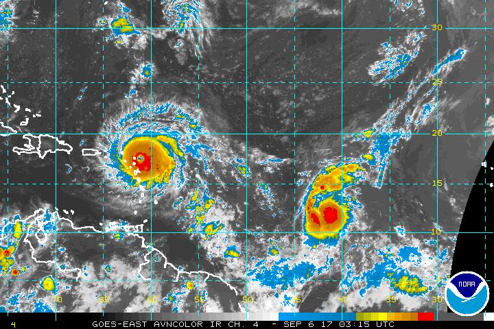
On this early Tuesday afternoon, Dorian has basically grinded to a halt in its forward motion while its winds have
Read MoreMonster Storm Slamming the Northwest Bahamas Over the past couple weeks, I’ve been monitoring Facebook and Twitter posts, and one
Read MoreJersey Shore to Begin Feeling the Effects from Cat 4 Storm Over Next Couple Days The clouds, rain, and wind
Read MoreStorm Still at Category Two Strength; Pressure down to 941 Millibars The 2017 Atlantic Hurricane Season continues to chug along,
Read MoreStorm Re-Strengthens to Have Winds of 125 MPH: Still Potential Problem for East Coast After pounding Dominica, St. Croix in
Read MoreWhile Jose meandered its way up the Eastern Seaboard this week, and created rough surf and dangerous rip currents along
Read MoreStorm Continues to Be a Minimal Hurricane Offshore in Mid-Atlantic Sorry for the lack of posts to the blog over
Read More