Storm History
Franklin’s Fury Far Away
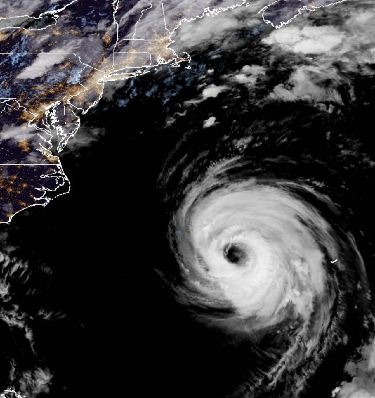
Hurricane Franklin has weaken to a minimal Category Three Hurricane after becoming the most powerful storm to date in the 2023 Atlantic Hurricane Season.
Read MoreApril 20, 2024
Blogging about weather events such as tropical storms and hurricanes, severe weather outbreaks, nor'easters and snowstorms affecting the Garden State.
Hurricane Franklin has weaken to a minimal Category Three Hurricane after becoming the most powerful storm to date in the 2023 Atlantic Hurricane Season.
Read More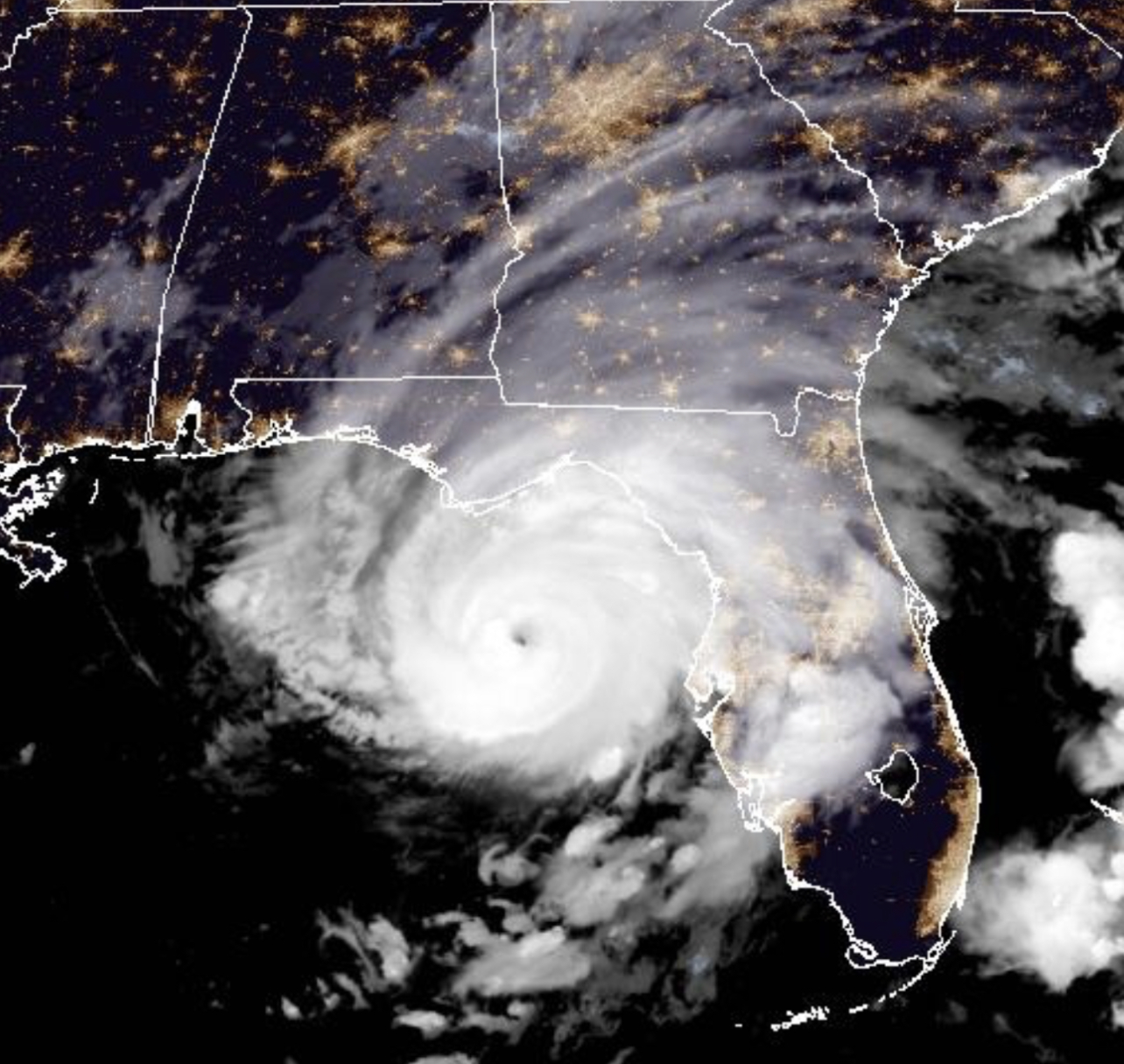
Category Three Hurricane Idalia bearing down on the Big Bend area of Northwest Florida during the early morning hours of August 30, 2023.
Read More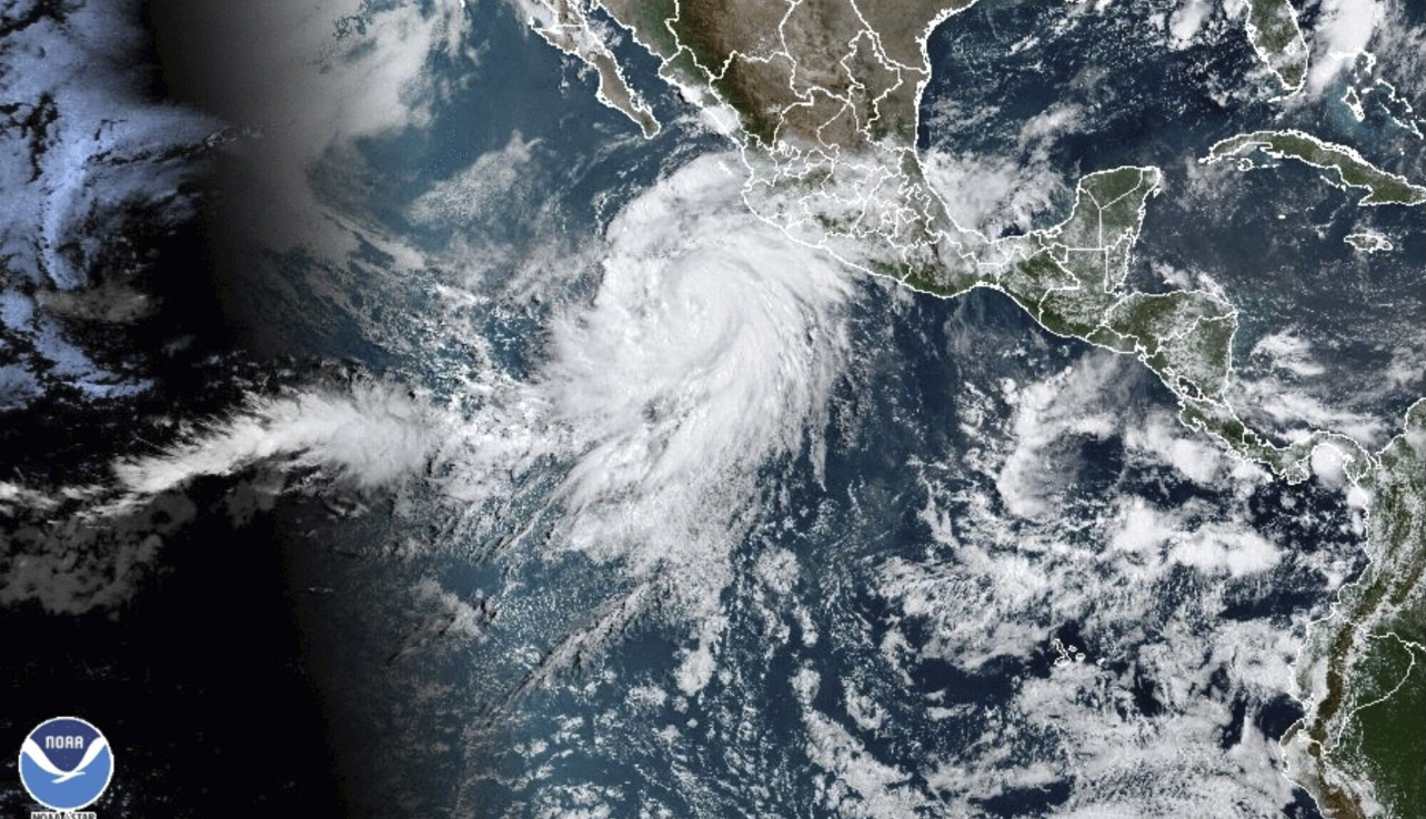
Tropical Trouble for California as once Category Four Hurricane Hilary becomes first Tropical Storm to hit Southern California in 84 Years.
Read More
Saturday afternoon’s Mammatus clouds at GWC was a harbinger of the severe weather outbreak.
Read MoreThe Comparison of the 2020 and 2005 Seasons Raises the Question: How Do You Quantify Tropical Activity? As we have
Read More
On this early Tuesday afternoon, Dorian has basically grinded to a halt in its forward motion while its winds have
Read MoreMonster Storm Slamming the Northwest Bahamas Over the past couple weeks, I’ve been monitoring Facebook and Twitter posts, and one
Read MoreJersey Shore to Begin Feeling the Effects from Cat 4 Storm Over Next Couple Days The clouds, rain, and wind
Read MoreStorm Still at Category Two Strength; Pressure down to 941 Millibars The 2017 Atlantic Hurricane Season continues to chug along,
Read MoreStorm Re-Strengthens to Have Winds of 125 MPH: Still Potential Problem for East Coast After pounding Dominica, St. Croix in
Read More