GWC News
Quake Jolts Garden State
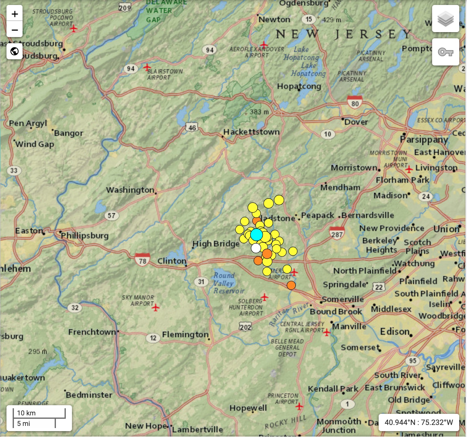
New Jersey Experiences Strongest Trembler Since End of Revolutionary War SOUTH PLAINFIELD, NJ – Minutes before 10:30 AM on Friday
Read MoreMay 5, 2024
Blogging about weather events such as tropical storms and hurricanes, severe weather outbreaks, nor'easters and snowstorms affecting the Garden State.
New Jersey Experiences Strongest Trembler Since End of Revolutionary War SOUTH PLAINFIELD, NJ – Minutes before 10:30 AM on Friday
Read More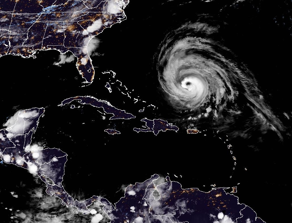
Satellite imager of Hurricane Lee in the Western Atlantic. Lee remains a major hurricane despite being in a weakening phase.
Read More
Large waves from Hurricane Franklin crashing ashore at Manasquan Beach on August 30, 2023.
Read More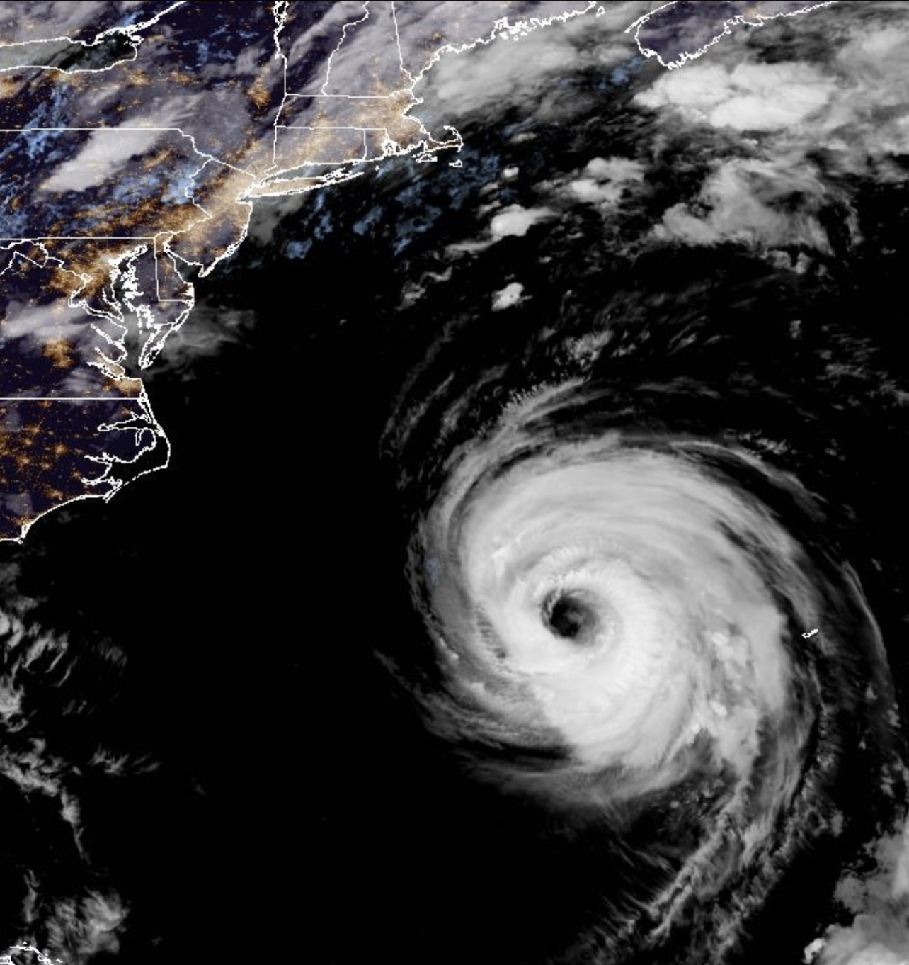
Hurricane Franklin has weaken to a minimal Category Three Hurricane after becoming the most powerful storm to date in the 2023 Atlantic Hurricane Season.
Read More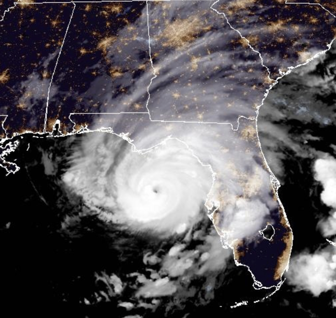
Category Three Hurricane Idalia bearing down on the Big Bend area of Northwest Florida during the early morning hours of August 30, 2023.
Read More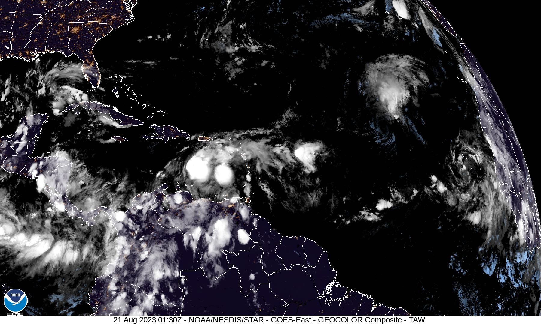
Satellite image of the Tropical Atlantic on the evening of August 20, 2023.
Read More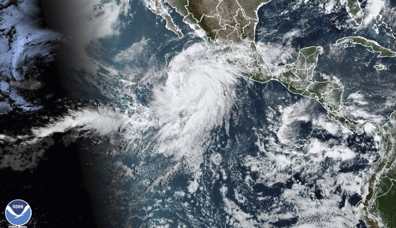
Tropical Trouble for California as once Category Four Hurricane Hilary becomes first Tropical Storm to hit Southern California in 84 Years.
Read MoreHurricane Dora Combines with High Pressure for Wind-Fueled Wildfires in Maui Use the coupon code: GWCHURRICANEVILLE, and get 10 percent
Read More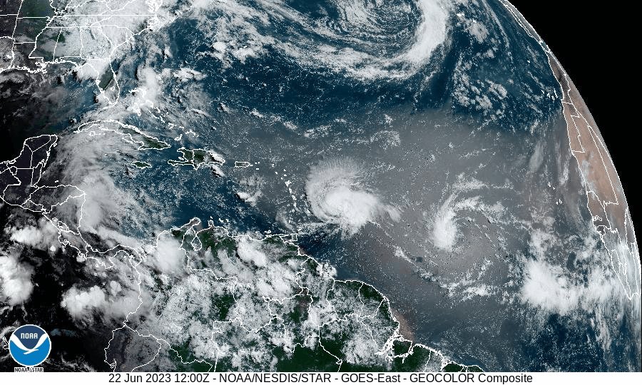
Tropical Storm Bret and Tropical Storm Cindy made news this past week as two rare named storms to form in the Eastern Atlantic.
Read More
The sun was obscured by an orange smoky haze over Spring Lake Park in South Plainfield, NJ on June 7th thanks to Canadian Wildfires.
Read More